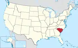
တောင်ကယ်ရိုလိုင်းနားပြည်နယ်
| တောင်ကယ်ရိုလိုင်းနားပြည်နယ် | |||||||||||
| |||||||||||
| ရုံးသုံးဘာသာစကားများ | English | ||||||||||
| မြို့သား | South Carolinian | ||||||||||
| မြို့တော် | ကိုလမ်ဘီယာ | ||||||||||
| အကြီးဆုံးမြို့ | မြို့တော် | ||||||||||
| အကြီးဆုံး မက်ထရိုဧရိယာ | Columbia (MSA) | ||||||||||
| ဧရိယာ | အမေရိကန်အဆင့် 40th | ||||||||||
| - စုစုပေါင်း | 32,020[1] စတုရန်းမိုင် (82,931. စတုရန်း ကီလိုမီတာ) | ||||||||||
| - အကျယ် | 200 miles (320 ကီလိုမီတာ) | ||||||||||
| - အရှည် | 260 miles (420 ကီလိုမီတာ) | ||||||||||
| - ရေရာခိုင်နှုန်း | 6 | ||||||||||
| - လတ္တီကျု | 32° 2′ N to 35° 13′ N | ||||||||||
| - လောင်ဂျီကျု | 78° 32′ W to 83° 21′ W | ||||||||||
| လူဦးရေ | အမေရိကန်အဆင့် 24th | ||||||||||
| - စုစုပေါင်း | 4,679,230 (2011 est) | ||||||||||
| - သိပ်သည်းမှု | 155/စတုရန်းမိုင် (60.0/စတုရန်းကီလိုမီတာ) အမေရိကန်အဆင့်19th | ||||||||||
| - အလယ်အလတ် ဝင်ငွေ | $39,326 (39th) | ||||||||||
| အမြင့် | |||||||||||
| - အမြင့်ဆုံးနေရာ | Sassafras Mountain[2][3] 3,560 ပေ (1,085 မီတာ) | ||||||||||
| - အလယ်အလတ် | 350 ပေ (110 မီတာ) | ||||||||||
| - အနိမ့်ဆုံးနေရာ | Atlantic Ocean[2] 0 ပေ (0 မီတာ) | ||||||||||
| ပြည်ထောင်စုသို့ ဝင်ရောက်ခြင်း |
May 23, 1788 (8th) | ||||||||||
| ပြည်နယ်အုပ်ချုပ်ရေးမှူး | Nikki Haley (R) | ||||||||||
| လက်ထောက် ပြည်နယ်အုပ်ချုပ်ရေးမှူး | Glenn McConnell (R) | ||||||||||
| ဥပဒေပြုလွှတ်တော် | General Assembly | ||||||||||
| - အထက်လွှတ်တော် | Senate | ||||||||||
| - အောက်လွှတ်တော် | House of Representatives | ||||||||||
| ဆီးနိတ်အမတ်များ | Lindsey Graham (R) Jim DeMint (R) | ||||||||||
| အောက်လွှတ်တော် အမတ်များ | 5 Republicans, 1 Democrat (list) | ||||||||||
| အချိန်ဇုန် | Eastern: UTC-5/-4 | ||||||||||
| အတိုကောက်များ | SC US-SC | ||||||||||
| အင်တာနက်စာမျက်နှာ | http://www.sc.gov | ||||||||||


ကိုးကား
- United States Summary: 2000။ United States Census Bureau (2000)။ January 20, 2012 တွင် ပြန်စစ်ပြီး။
- Elevations and Distances in the United States။ United States Geological Survey (2001)။ October 24, 2011 တွင် ပြန်စစ်ပြီး။
- Elevation adjusted to North American Vertical Datum of 1988.
This article is issued from Wikipedia. The text is licensed under Creative Commons - Attribution - Sharealike. Additional terms may apply for the media files.