ဥဒယဌာနီပြည်နယ်
ဥဒယဌာနီ သို့ ဥထိုင်းဌာနီပြည်နယ် ( ထိုင်း: อุทัยธานี အသံထွက် [ʔù.tʰāj tʰāː.nīː] ) သည် ထိုင်းနိုင်ငံ၏ ပြည်နယ် ၇၇ခုအနက်မှ ပြည်နယ်တစ်ခုဖြစ်ပြီး ထိုင်းနိုင်ငံမြောက်ပိုင်း တွင်တည်ရှိပါသည်။ အိမ်နီးချင်းပြည်နယ်များမှာ (မြောက်ဘက်မှနာရီလက်တံအတိုင်းရေ တွက်ြကည့်ပါ) နခွန်စဝမ်၊ ချိုင်နတ်၊ ဆူဖန်ဘူရီ၊ ကန်ချနဘူရီနှင့် တခ်တို့ဖြစ်ပါသည်။ ၎င်းသည် ဘန်ကောက်နှင့် ချင်းမိုင် ကြားရှိ ကီလိုမီတာ၂၀၀အကွာအဝေးလမ်းကြောင်းတွင်တည်ရှိပါသည်။။ [4]
| Uthai Thani อุทัยธานี | |||
|---|---|---|---|
| Province | |||
 Wat Chan Tharam | |||
| |||
| နာမည်ပြောင်(များ): Uthai | |||
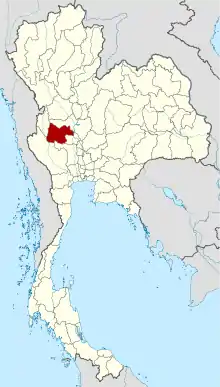 Map of Thailand highlighting Uthai Thani Province | |||
| Country | Thailand | ||
| Capital | Uthai Thani | ||
| အစိုးရ | |||
| • Governor | Narong Rakhot | ||
| ဧရိယာ[1] | |||
| • စုစုပေါင်း | ၆,၇၃၀ စတုရန်းကီလိုမီတာ (၂၆၀၀ စတုရန်းမိုင်) | ||
| ဧရိယာအဆင့် | Ranked 29th | ||
| လူဦးရေ (2018)[2] | |||
| • စုစုပေါင်း | ၃၂၉,၄၃၃ | ||
| • အဆင့် | Ranked 67th | ||
| • သိပ်သည်းမှု | ၄၉/km၂ (၁၃၀/sq mi) | ||
| • သိပ်သည်းမှု အဆင့် | Ranked 73rd | ||
| Human Achievement Index[3] | |||
| • HAI (2017) | 0.5508 "low" Ranked 64th | ||
| အချိန်ဇုန် | ICT (UTC+7) | ||
| Postal code | 61xxx | ||
| Calling code | 056 | ||
| ISO 3166 ကုဒ် | TH-61 | ||
| ဝက်ဘ်ဆိုဒ် | uthaithani.go.th | ||


ကိုးကား
- Advancing Human Development through the ASEAN Community, Thailand Human Development Report 2014, table 0:Basic Data (PDF) (အစီရင်ခံစာ)။ United Nations Development Programme (UNDP) Thailand။ pp. 134–135။ ISBN 978-974-680-368-7။ 17 January 2016 တွင် ပြန်စစ်ပြီး, Data has been supplied by Land Development Department, Ministry of Agriculture and Cooperatives, at Wayback Machine.
- รายงานสถิติจำนวนประชากรและบ้านประจำปี พ.ศ.2561 (in th) (31 December 2018)။
- Human achievement index 2017 by National Economic and Social Development Board (NESDB), pages 1-40, maps 1-9, retrieved 14 September 2019, ISBN 978-974-9769-33-1
- Uthai Thani။ 7 September 2015 တွင် မူရင်းအား မော်ကွန်းတင်ပြီး။ 14 January 2021 တွင် ပြန်စစ်ပြီး။
This article is issued from Wikipedia. The text is licensed under Creative Commons - Attribution - Sharealike. Additional terms may apply for the media files.