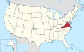
ဗာဂျီးနီးယားပြည်နယ်
| ဗာဂျီးနီးယား ဓနသဟာယ ပြည်နယ် | |||||||||||
| |||||||||||
| ရုံးသုံးဘာသာစကားများ | English | ||||||||||
| ပြောဆိုသော ဘာသာစကားများ | English 94.6%, Spanish 5.9% | ||||||||||
| မြို့သား | Virginian | ||||||||||
| မြို့တော် | Richmond | ||||||||||
| အကြီးဆုံးမြို့ | Virginia Beach | ||||||||||
| အကြီးဆုံး မက်ထရိုဧရိယာ | Northern Virginia | ||||||||||
| ဧရိယာ | အမေရိကန်အဆင့် 35th | ||||||||||
| - စုစုပေါင်း | 42,774.2 စတုရန်းမိုင် (110,785.67 စတုရန်း ကီလိုမီတာ) | ||||||||||
| - အကျယ် | 200 miles (320 ကီလိုမီတာ) | ||||||||||
| - အရှည် | 430 miles (690 ကီလိုမီတာ) | ||||||||||
| - ရေရာခိုင်နှုန်း | 7.4 | ||||||||||
| - လတ္တီကျု | 36° 32′ N to 39° 28′ N | ||||||||||
| - လောင်ဂျီကျု | 75° 15′ W to 83° 41′ W | ||||||||||
| လူဦးရေ | အမေရိကန်အဆင့် 12th | ||||||||||
| - စုစုပေါင်း | 8,096,604 (2011 est) | ||||||||||
| - သိပ်သည်းမှု | 204/စတုရန်းမိုင် (79.0/စတုရန်းကီလိုမီတာ) အမေရိကန်အဆင့်14th | ||||||||||
| - အလယ်အလတ် ဝင်ငွေ | $61,044[1] (8th) | ||||||||||
| အမြင့် | |||||||||||
| - အမြင့်ဆုံးနေရာ | Mount Rogers[2][3] 5,729 ပေ (1746 မီတာ) | ||||||||||
| - အလယ်အလတ် | 950 ပေ (290 မီတာ) | ||||||||||
| - အနိမ့်ဆုံးနေရာ | Atlantic Ocean[2] 0 ပေ (0 မီတာ) | ||||||||||
| ပြည်ထောင်စုသို့ ဝင်ရောက်ခြင်း |
June 25, 1788 (10th) | ||||||||||
| ပြည်နယ်အုပ်ချုပ်ရေးမှူး | Bob McDonnell (R) | ||||||||||
| လက်ထောက် ပြည်နယ်အုပ်ချုပ်ရေးမှူး | Bill Bolling (R) | ||||||||||
| ဥပဒေပြုလွှတ်တော် | General Assembly | ||||||||||
| - အထက်လွှတ်တော် | Senate | ||||||||||
| - အောက်လွှတ်တော် | House of Delegates | ||||||||||
| ဆီးနိတ်အမတ်များ | Jim Webb (D) Mark Warner (D) | ||||||||||
| အောက်လွှတ်တော် အမတ်များ | 8 Republicans, 3 Democrats (list) | ||||||||||
| အချိန်ဇုန် | Eastern: UTC −5/−4 | ||||||||||
| အတိုကောက်များ | VA US-VA | ||||||||||
| အင်တာနက်စာမျက်နှာ | http://www.virginia.gov | ||||||||||


ကိုးကား
- Median household income in the past 12 months (in 2007 inflation-adjusted dollars)။ American Community Survey။ United States Census Bureau (2007)။ 12 February 2020 တွင် မူရင်းအား မော်ကွန်းတင်ပြီး။ September 2, 2008 တွင် ပြန်စစ်ပြီး။
- Elevations and Distances in the United States။ United States Geological Survey (2001)။ October 24, 2011 တွင် ပြန်စစ်ပြီး။
- Elevation adjusted to North American Vertical Datum of 1988.
This article is issued from Wikipedia. The text is licensed under Creative Commons - Attribution - Sharealike. Additional terms may apply for the media files.