အိုဟိုင်းယိုးပြည်နယ်
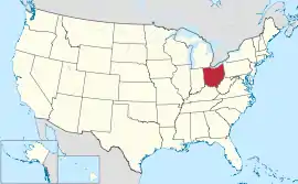
အိုဟိုင်းယိုးပြည်နယ်သည် အမေရိကန်နိုင်ငံ အလယ်ပိုင်းပြည်နယ်တို့တွင် မြောက်ဘက်ကျသော ပြည်နယ်တစ်နယ်ဖြစ်၍ အိုဟိုင်းယိုးမြစ်သည် ပြည်နယ်၏ တောင်ဘက်နှင့် အရှေ့တောင်ဘက် နယ်နိမိတ်အဖြစ် စီးဆင်းသည်။ မြောက်ဘက်တွင် မီချီဂန်ပြည်နယ်နှင့် အီရီအိုင်ရှိ၍၊ အရှေ့နှင့်အရှေ့တောင်ဘက်တွင် ပင်ဆယ်ဗေးနီးယားပြည်နယ်နှင့် အနောက် ဗာဂျီးနီးယားပြည်နယ်တို့ တည်ရှိသည်။ တောင်ဘက်တွင် ကင်တပ်ကီပြည်နယ်နှင့် အနောက်ဘက်တွင် အင်ဒီယားနားပြည်နယ်တို့ အသီးသီးတည်ရှိကြသည်။ အိုဟိုင်းယိုးပြည်နယ်သည် စတုရန်းမိုင်ပေါင်း ၄၄,၈၂၅ ကျယ်ဝန်း၍ လူဦးရေ ၁၁,၅၇၀,၈၀၈ (၂၀၁၃ ခန့်မှန်း) ရှိသည်။
| အိုဟိုင်းယိုးပြည်နယ် | |||||||||||
| |||||||||||
| ရုံးသုံးဘာသာစကားများ | De jure: None De facto: English | ||||||||||
| ပြောဆိုသော ဘာသာစကားများ | အင်္ဂလိပ်ဘာသာ ၉၃.၃% စပိန်ဘာသာ ၂.၂% အခြား ၄.၅%[1] | ||||||||||
| မြို့သား | Ohioan; Buckeye (colloq.) | ||||||||||
| မြို့တော် | ကိုလံဘတ်မြို့[2] | ||||||||||
| အကြီးဆုံးမြို့ | မြို့တော် | ||||||||||
| အကြီးဆုံး မက်ထရိုဧရိယာ | Greater Cleveland (see footnote[3]) | ||||||||||
| ဧရိယာ | အမေရိကန်အဆင့် ၃၄ ခုမြောက် | ||||||||||
| - စုစုပေါင်း | ၄၄,၈၂၅ စတုရန်းမိုင် (၁၁၆,၀၉၆ စတုရန်း ကီလိုမီတာ) | ||||||||||
| - အကျယ် | ၂၂၀ miles (၃၅၅ ကီလိုမီတာ) | ||||||||||
| - အရှည် | ၂၂၀ miles (၃၅၅ ကီလိုမီတာ) | ||||||||||
| - ရေရာခိုင်နှုန်း | ၈.၇ | ||||||||||
| - လတ္တီကျု | 38° 24′ N to 41° 59′ N | ||||||||||
| - လောင်ဂျီကျု | 80° 31′ W to 84° 49′ W | ||||||||||
| လူဦးရေ | အမေရိကန်အဆင့် သတ္တမမြောက် | ||||||||||
| - စုစုပေါင်း | ၁၁,၅၇၀,၈၀၈ (၂၀၁၃ ခန့်မှန်း) | ||||||||||
| - သိပ်သည်းမှု | ၂၈၂/စတုရန်းမိုင် (၁၀၉/စတုရန်းကီလိုမီတာ) အမေရိကန်အဆင့်ဒဿမမြောက် | ||||||||||
| - အလယ်အလတ် ဝင်ငွေ | $၄၈,၀၇၁ (၂၀၁၁) (33rd) | ||||||||||
| အမြင့် | |||||||||||
| - အမြင့်ဆုံးနေရာ | Campbell Hill[4][5] ၁,၅၄၉ ပေ (၄၇၂ မီတာ) | ||||||||||
| - အလယ်အလတ် | ၈၅၀ ပေ (၂၆၀ မီတာ) | ||||||||||
| - အနိမ့်ဆုံးနေရာ | Ohio River at Indiana border[4][5] ၄၅၅ ပေ (၁၃၉ မီတာ) | ||||||||||
| ပြည်ထောင်စုသို့ ဝင်ရောက်ခြင်း |
၁ မတ် ၁၈၀၃ (17th, declared retroactively on August 7, 1953[6]) | ||||||||||
| ပြည်နယ်အုပ်ချုပ်ရေးမှူး | John Kasich (R)[7] | ||||||||||
| လက်ထောက် ပြည်နယ်အုပ်ချုပ်ရေးမှူး | Mary Taylor[8] (R)[9] | ||||||||||
| ဥပဒေပြုလွှတ်တော် | Ohio General Assembly | ||||||||||
| - အထက်လွှတ်တော် | Ohio Senate | ||||||||||
| - အောက်လွှတ်တော် | Ohio House of Representatives | ||||||||||
| ဆီးနိတ်အမတ်များ | Sherrod Brown[10] (D)[10] Rob Portman (R) | ||||||||||
| အောက်လွှတ်တော် အမတ်များ | 12 Republicans, 4 Democrats (list) | ||||||||||
| အချိန်ဇုန် | Eastern: UTC -5/-4 | ||||||||||
| အတိုကောက်များ | OH[11] US-OH | ||||||||||
| အင်တာနက်စာမျက်နှာ | http://www.ohio.gov | ||||||||||


အိုဟိုင်းယိုးဟူသောအမည်သည် အင်ဒီးယန်းလူမျိုးဘာသာစကားဖြင့် ကြီးသည်ဟု ဆိုလိုသည်။ နယ်နိမိတ်အဖြစ် စီးဆင်းသော အိုဟိုင်းယိုးမြစ်ကိုအစွဲပြု၍ ပြည်နယ်ကို အိုဟိုင်းယိုး ပြည်နယ်ဟု မှည့်ခေါ်ကြသည်။ အိုဟိုင်းယိုးပြည်နယ် အရှေ့ပိုင်းသည် ကုန်းပြင်မြင့်ဒေသ ဖြစ်၍ ကျန်အပိုင်းများမှာ ကုန်းနိမ့်တန်းများဖြင့် မညီမညာရှိ သောလွင်ပြင်ဒေသဖြစ်သည်။ မြောက်ပိုင်းတွင် မောမီးမြစ်သည် ထင်ရှား၍ တောင်ပိုင်းရှိ မြစ်များမှာမူကား အိုဟိုင်းယိုးမြစ်၏ မြစ်လက်တက်များဖြစ်လေသည်။[12]
ကိုးကား
| Wikimedia Commons တွင် Ohio နှင့် ပတ်သက်သော မီဒီယာ ရှိသည်။ |
- American FactFinder - Results
- Ohio Quick Facts။ Ohio Historical Society။ March 26, 2009 တွင် ပြန်စစ်ပြီး။
- According to the U.S. Census July 2007 Annual Estimate, Greater Cleveland is the largest Metropolitan Statistical Area (MSA) that is entirely within Ohio, with a population of 2,096,471; and Greater Cincinnati is the largest MSA that is at least partially within Ohio, with a population of 2,133,678, approximately 25% of which is in Indiana or Kentucky. Which MSA is the largest in Ohio depends on the context.
- Elevations and Distances in the United States။ United States Geological Survey (2001)။ October 24, 2011 တွင် ပြန်စစ်ပြီး။
- Elevation adjusted to North American Vertical Datum of 1988.
- Creation of the Board of Elections။ Mahoning County Board of Elections။ March 25, 2009 တွင် ပြန်စစ်ပြီး။
- Hershey၊ William။ "Strickland becomes first Dem governor since '91"၊ Middletown Journal၊ November 8, 2006။ March 25, 2009 တွင် ပြန်စစ်ပြီး။ Archived from the original on 12 May 2011။
- About Lee။ Office of the Governor (2009)။ March 25, 2009 တွင် ပြန်စစ်ပြီး။
- "Democrats Jennifer Brunner, Lee Fisher to run for U.S. Senate"၊ February 17, 2009။ March 27, 2009 တွင် ပြန်စစ်ပြီး။
- Sherrod Brown။ Washington Post။ March 27, 2009 တွင် ပြန်စစ်ပြီး။
- Official USPS Abbreviations။ United States Postal Service (1998)။ March 26, 2009 တွင် ပြန်စစ်ပြီး။
- မြန်မာ့စွယ်စုံကျမ်း၊ အတွဲ(၁၅)