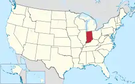
အင်ဒီယားနားပြည်နယ်
| အင်ဒီယားနားပြည်နယ် | |||||||||||
| |||||||||||
| ရုံးသုံးဘာသာစကားများ | English | ||||||||||
| ပြောဆိုသော ဘာသာစကားများ | General American English; Inland North American and Midland Dialects, Other Languages | ||||||||||
| မြို့သား | Hoosier[1] | ||||||||||
| မြို့တော် | အင်ဒီယားနားပိုလစ် | ||||||||||
| အကြီးဆုံးမြို့ | Indianapolis | ||||||||||
| အကြီးဆုံး မက်ထရိုဧရိယာ | Indianapolis metropolitan area | ||||||||||
| ဧရိယာ | အမေရိကန်အဆင့် 38th | ||||||||||
| - စုစုပေါင်း | 36,418 စတုရန်းမိုင် (94,321 စတုရန်း ကီလိုမီတာ) | ||||||||||
| - အကျယ် | 140 miles (225 ကီလိုမီတာ) | ||||||||||
| - အရှည် | 270 miles (435 ကီလိုမီတာ) | ||||||||||
| - ရေရာခိုင်နှုန်း | 1.5 | ||||||||||
| - လတ္တီကျု | 37° 46′ N to 41° 46′ N | ||||||||||
| - လောင်ဂျီကျု | 84° 47′ W to 88° 6′ W | ||||||||||
| လူဦးရေ | အမေရိကန်အဆင့် 17th | ||||||||||
| - စုစုပေါင်း | 6,732,219 (2019 est) | ||||||||||
| - သိပ်သည်းမှု | 184.9/စတုရန်းမိုင် (71.4/စတုရန်းကီလိုမီတာ) အမေရိကန်အဆင့်16th | ||||||||||
| အမြင့် | |||||||||||
| - အမြင့်ဆုံးနေရာ | Hoosier Hill[2][3] 1,257 ပေ (383 မီတာ) | ||||||||||
| - အလယ်အလတ် | 700 ပေ (210 မီတာ) | ||||||||||
| - အနိမ့်ဆုံးနေရာ | Confluence of Ohio River and Wabash River[2][3] 320 ပေ (97 မီတာ) | ||||||||||
| ပြည်ထောင်စုသို့ ဝင်ရောက်ခြင်း |
December 11, 1816 (19th) | ||||||||||
| ပြည်နယ်အုပ်ချုပ်ရေးမှူး | Eric J. Holcomb (R) | ||||||||||
| လက်ထောက် ပြည်နယ်အုပ်ချုပ်ရေးမှူး | Suzanne Crouch (R) | ||||||||||
| ဥပဒေပြုလွှတ်တော် | General Assembly | ||||||||||
| - အထက်လွှတ်တော် | Senate | ||||||||||
| - အောက်လွှတ်တော် | House of Representatives | ||||||||||
| ဆီးနိတ်အမတ်များ | Todd Young (R) Mike Braun (R) | ||||||||||
| အောက်လွှတ်တော် အမတ်များ | 7 Republicans, 2 Democrats (list) | ||||||||||
| စံတော်ချိန်ဇုန်များ | |||||||||||
| - 80 counties | Eastern: UTC -5/-4 | ||||||||||
| - 12 counties in Evansville and Gary Metro Areas For more information, see Time in Indiana | Central: UTC -6/-5 | ||||||||||
| အတိုကောက်များ | IN US-IN | ||||||||||
| အင်တာနက်စာမျက်နှာ | http://www.in.gov | ||||||||||


ကိုးကား
- "What to Call Elsewherians and why"၊ CNN၊ November 7, 2007။ 2008-10-04 တွင် ပြန်စစ်ပြီး။
- Elevations and Distances in the United States။ United States Geological Survey (2001)။ October 21, 2011 တွင် ပြန်စစ်ပြီး။
- Elevation adjusted to North American Vertical Datum of 1988.
This article is issued from Wikipedia. The text is licensed under Creative Commons - Attribution - Sharealike. Additional terms may apply for the media files.