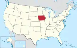
အိုင်အိုဝါပြည်နယ်
| အိုင်အိုဝါပြည်နယ် | |||||||||||
| |||||||||||
| ရုံးသုံးဘာသာစကားများ | English | ||||||||||
| မြို့သား | Iowan | ||||||||||
| မြို့တော် | Des Moines | ||||||||||
| အကြီးဆုံးမြို့ | capital | ||||||||||
| အကြီးဆုံး မက်ထရိုဧရိယာ | Des Moines metropolitan area | ||||||||||
| ဧရိယာ | အမေရိကန်အဆင့် 26th | ||||||||||
| - စုစုပေါင်း | 56,272 စတုရန်းမိုင် (145,743 စတုရန်း ကီလိုမီတာ) | ||||||||||
| - အကျယ် | 310 miles (500 ကီလိုမီတာ) | ||||||||||
| - အရှည် | 199 miles (320 ကီလိုမီတာ) | ||||||||||
| - ရေရာခိုင်နှုန်း | 0.70 | ||||||||||
| - လတ္တီကျု | 40° 23′ N to 43° 30′ N | ||||||||||
| - လောင်ဂျီကျု | 90° 8′ W to 96° 38′ W | ||||||||||
| လူဦးရေ | အမေရိကန်အဆင့် 30th | ||||||||||
| - စုစုပေါင်း | 3,062,309 (2011 est) | ||||||||||
| - သိပ်သည်းမှု | 54.8/စတုရန်းမိုင် (21.2/စတုရန်းကီလိုမီတာ) အမေရိကန်အဆင့်36th | ||||||||||
| - အလယ်အလတ် ဝင်ငွေ | $48,075 (24th) | ||||||||||
| အမြင့် | |||||||||||
| - အမြင့်ဆုံးနေရာ | Hawkeye Point[2][3] 1,671 ပေ (509 မီတာ) | ||||||||||
| - အလယ်အလတ် | 1,100 ပေ (340 မီတာ) | ||||||||||
| - အနိမ့်ဆုံးနေရာ | Confluence of Mississippi River and Des Moines River[2][3] 480 ပေ (146 မီတာ) | ||||||||||
| ပြည်ထောင်စုသို့ ဝင်ရောက်ခြင်း |
December 28, 1846 (29th) | ||||||||||
| ပြည်နယ်အုပ်ချုပ်ရေးမှူး | Terry E. Branstad (R) | ||||||||||
| လက်ထောက် ပြည်နယ်အုပ်ချုပ်ရေးမှူး | Kim Reynolds (R) | ||||||||||
| ဥပဒေပြုလွှတ်တော် | General Assembly | ||||||||||
| - အထက်လွှတ်တော် | Senate | ||||||||||
| - အောက်လွှတ်တော် | House of Representatives | ||||||||||
| ဆီးနိတ်အမတ်များ | Chuck Grassley (R) Tom Harkin (D) | ||||||||||
| အောက်လွှတ်တော် အမတ်များ | 3 Democrats, 2 Republicans (list) | ||||||||||
| အချိန်ဇုန် | Central: UTC -6/-5 | ||||||||||
| အတိုကောက်များ | IA US-IA | ||||||||||
| အင်တာနက်စာမျက်နှာ | http://www.iowa.gov | ||||||||||


ကိုးကား
- State Symbols။ Iowa Department of Economic Development။ 2 September 2011 တွင် မူရင်းအား မော်ကွန်းတင်ပြီး။ September 9, 2011 တွင် ပြန်စစ်ပြီး။
- Elevations and Distances in the United States။ United States Geological Survey (2001)။ October 21, 2011 တွင် ပြန်စစ်ပြီး။
- Elevation adjusted to North American Vertical Datum of 1988.
This article is issued from Wikipedia. The text is licensed under Creative Commons - Attribution - Sharealike. Additional terms may apply for the media files.